OPC Pacific Surface Analysis
Most recent NOAA Ocean Prediction Center (OPC) Pacific Surface Analysis plots for the Pacific Ocean basin.
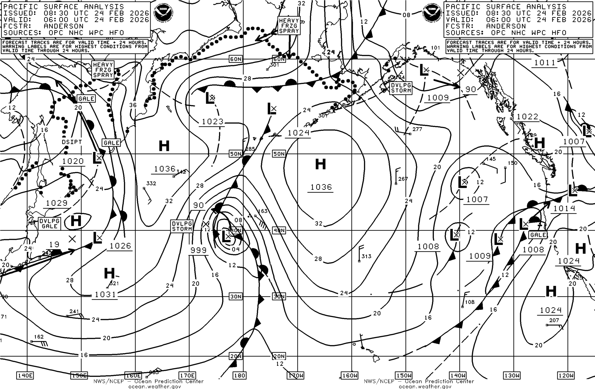
The image below is a copy of the most recent OPC Surface Analysis for the Pacific Ocean, detailing surface pressure isobars, spaced at 4 mbar. Highs and Lows are depicted by H and L, respectively. Pressure at the low and high centers is underlined and printed in full (mbar). Arrows from an X near a low to another X show the 24 predicted movement of the low. Cold and warm fronts are shown as solid lines with filled triangles or half-rounds, respectively. Occluded fronts are a mix of triangles and half-rounds. Stationary fronts are depicted by triangles or half-rounds on either side of the frontal line. If the frontal line is long-dashed, this indicates a dissipating front. Wind barbs are recent ship/buoy observations and the number reported near them represents surface pressure (e.g. 022 = 1002.2 mbar). Long feathers are 10 kt, half feathers are 5 kt. Please note that these indicate ranges: i.e. a barb with one long feather means winds from 7.5 to 12.5 knots.
Below: Static maps (like that above) for the previous four synoptic times.
Note: OPC surface analyses are available within ~3 hours of model run time. This is due to the analyses being created by real humans.